 Genius Asian
 Máyyan 'Ooyákma – Coyote Ridge: 7 Things to Know Before Your First Hike
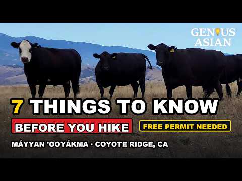
Máyyan ‘Ooyákma – Coyote Ridge: 7 Things to Know Before Your First Hike
Máyyan ‘Ooyákma – Coyote Ridge is one of the newest and most unusual places to hike in the South Bay. It is 1,859 protected acres of rare serpentine grassland on the ridge above the Coyote Valley, with roughly five miles of trail, about 1,400 feet of climbing to the ridgeline, and a view that stretches across Silicon Valley on a clear day.
It is also a preserve with rules and quirks that surprise first-time visitors. You need a permit you have to get before you arrive. There is essentially no shade. And there is a very good chance a herd of cattle will be standing directly on the trail you planned to walk.
Here are the seven things worth knowing before you drive out.
Quick Facts
- Where: Malech Road staging area, Morgan Hill, CA — just south of San Jose off US‑101
- Managed by: Santa Clara Valley Open Space Authority
- Size: 1,859 acres, about 5 miles of multi-use trail
- Climb: roughly 1,400 feet from the staging area to the ridgeline
- Permit: free annual Butterfly Pass, required for the Habitat Protection Area trails
- Parking: free, 42 spaces, with restrooms at the trailhead
- Not allowed: dogs and drones, anywhere in the preserve
- Name meaning: “Máyyan ‘Ooyákma” translates to Coyote Ridge in the Chochenyo language
1. Cows May Be on the Trail — Sometimes Just Standing There Staring at You
This is the one that catches people off guard. The preserve uses conservation grazing — local ranchers run cattle on the land to knock back invasive grasses that would otherwise crowd out the native serpentine plants. The grazing is a management tool, not an accident, which means the cattle have the run of the place and regularly stand right in the middle of the trail.
Decide your strategy before you go, not while a 1,200-pound animal is looking at you:
- Don’t run. Running triggers a chase response.
- Keep your eyes on the cow and slowly put distance between you.
- Give them time and space to move away. They usually will, on their own schedule.
- Never get between a mother and her calf. This is the single most reliable way to provoke a cow.
- Don’t follow cow paths. The braided dirt tracks crossing the hillsides are made by cattle, not people — stay on the designated trail.
Cattle are calm animals when they aren’t crowded. Most encounters here end with the herd ambling off the trail while you wait thirty seconds.
2. Pick Your Direction Based on Where the Steep Section Lands
The loop can be walked in either direction, and the direction you choose completely changes the difficulty profile. There is one genuinely steep stretch on this loop, and you get to decide whether you go up it or down it.
- Start from the left (clockwise): you climb the Serpentine Spring Trail early — roughly 1,000 feet of gain packed into about 1.3 miles. It is a short, hard, front-loaded climb, and then the rest of the loop is comparatively easy. Choose this if steep downhills bother your knees.
- Start from the right (counterclockwise): you climb the Bay Checkerspot Trail instead, where a similar 1,000 feet is spread over about 2.5 miles — a much more gradual ascent. The trade-off is that you come down the steep Serpentine Spring section at the end.
Along the top, the Tule Elk Trail runs about 1.3 miles across the ridge with almost no elevation change — this is the payoff section, with ridgetop views in both directions. About three miles of trail here is part of the Bay Area Ridge Trail.
There is also a short, easy option: the Máyyan Wáayi (Coyote Valley) Overlook Trail, about 1,000 feet long on a gentle grade from the central gathering area, with a shaded picnic spot. It sits outside the Habitat Protection Area, so it does not require a pass.
3. Cool Breeze, Zero Shade
The ridge catches a steady breeze, which is pleasant and also deceptive — you will not feel how much sun you are taking.
The trails are almost completely exposed. There is no tree cover to duck under on the climb, and very little at the top. Plan accordingly:
- Check the forecast and pick an overcast day, or start early in the morning.
- Bring sun protection: hat, sunglasses, sunscreen, long sleeves if you burn.
- Bring more water than you think you need — a fully exposed 5-mile loop with 1,400 feet of climbing drinks water fast.
- The breeze can be genuinely cold on the ridge in winter and early spring. A wind layer is worth the pack space.
4. A Free Permit Is Required — the Butterfly Pass
This is the detail that turns people around at the gate. To hike, bike, or ride the trails inside the Habitat Protection Area — which is where the good trails are — every visitor needs a Butterfly Pass.
The important parts:
- It is free, and it is issued annually (there is a current-year pass).
- You register online before you arrive. Do not count on doing it at the trailhead.
- Save it to your phone or print it before you go.
- Getting the pass means agreeing to the preserve’s Habitat Protection Area guidelines — stay on designated trails, pack out everything, and use the boot- and tire-cleaning stations to avoid spreading invasive seeds and plant disease.
The pass exists because this is not ordinary grassland. The serpentine soil here supports the rare plants that host the endangered Bay checkerspot butterfly, one of the best-known endangered insects in California. The habitat is genuinely fragile, and the trail-only rule is what keeps it intact.
Two more rules that catch visitors out:
- No dogs, anywhere in the preserve. Not on leash, not in the parking lot area trails — nowhere.
- No drones, anywhere.
- Hours change with the season. The Authority runs the preserve on what it calls “nature time,” so opening and closing times shift through the year. Check the operations calendar before you drive out.
5. It Won’t Be Silent Out There
If you are picturing total wilderness quiet, adjust your expectations before you arrive rather than being unnerved on the ridge.
You will hear two things:
- Highway traffic from US‑101 below the preserve.
- Gunfire — steady, and sometimes rapid — from the shooting range at Santa Clara County’s Field Sports Park, which sits immediately next to the preserve. The trail map even marks the range boundary as a no-trespassing active gun range.
It is completely normal and expected. Nothing is wrong, nobody is shooting anywhere near the trail, and there is no reason to be alarmed. It is simply what this particular ridge sounds like.
6. Crowds Are Seasonal — Wildflower Season Changes Everything
Most of the year the preserve is quiet and you may pass only a handful of other hikers.
Then March through May arrives. The serpentine grassland produces one of the best wildflower displays in the Bay Area, and the crowds follow. If you want solitude, come outside the spring bloom. If you want the flowers, come in spring and accept the company.
Spring weekends also come with extra rules. In recent seasons the Authority has restricted bikes and horses on Saturdays and Sundays during March–May, and has run reservation-only docent-led hikes in parts of the Habitat Protection Area during that window. These seasonal rules change year to year, so check the preserve’s current operations calendar before planning a spring weekend visit — especially if you are riding rather than walking.
7. You’ll Deal With Gates and Cattle Guards
Because cattle are actively managed here, the trail is divided by infrastructure that you have to operate yourself.
Expect two things:
- Gates with cattle latches. Several gates along the route use latch mechanisms designed to defeat curious cattle. Some take a moment to figure out — lift, slide, swing. That’s normal.
- Cattle guards. Also called cattle grates or grids: a set of parallel bars set into the ground that cattle won’t step across. You can usually open the gate next to them instead, or step across the guard itself — carefully. The gaps are exactly the right size to catch a foot or a trekking pole tip. Watch your footing.
Whichever you use, the rule is the same and it matters: leave every gate the way you found it. A gate left open moves cattle into a section of grassland where the grazing plan didn’t call for them — which undoes the habitat work the whole preserve exists to do.
What to Bring
- Butterfly Pass (on your phone or printed)
- More water than feels necessary — there’s no water on the trail
- Sun hat, sunglasses, sunscreen
- Wind layer for the ridge
- Shoes with real tread for the steep section
- Snacks — a 5-mile loop with 1,400 feet of gain takes most people 2.5 to 3.5 hours
Wildlife You Might See
Beyond the cattle: Bay checkerspot butterflies in spring, tule elk, golden eagles, California red-legged frogs, and California tiger salamanders. Staying on designated trails also lowers your odds of an unwanted encounter with rattlesnakes, ticks, and poison oak.
Official Links
- Butterfly Pass registration: openspaceauthority.org/butterfly-pass
- Preserve page, hours, and operations calendar: openspaceauthority.org/preserve/mayyan-ooyakma-coyote-ridge
The Short Version
Get the free Butterfly Pass before you leave home. Pick your direction based on whether you’d rather climb the steep part or descend it. Bring sun protection and extra water, because there is no shade. Don’t be startled by the gunfire. Expect company in spring. Give the cattle room, never come between a cow and her calf, and close every gate behind you.
Do those seven things and Máyyan ‘Ooyákma is one of the best ridge walks in the South Bay.
Have you hiked Coyote Ridge? Leave your own tips in the comments on the video — the trail conditions and seasonal rules here change more than most Bay Area preserves.